The Brimson Forest Fire
May 2025
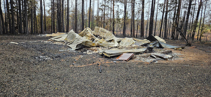
In the late 1970s two friends and I invested in a three room cabin on thirty acres embedded in Superior National Forest in Northern Minnesota. That cabin and other buildings are no more after the Camp House Road forest fire swept through.

This is all that's left after the fire this week…
We also had a nice little Finnish sauna that came with the property.
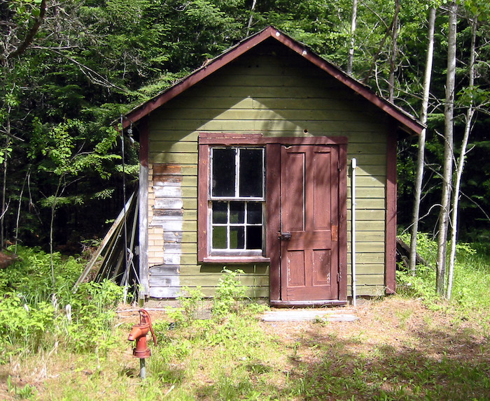
That too is no more…
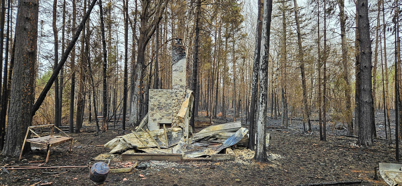
This was the situation when my friends had to evacuate suddenly. The fire allegedly started when a campfire was left unattended on private property near the intersection of Camp House Road and Highway 44. It was very dry and the wind was gusting from the SW. The fire quickly spread to over 1000 acres as seen on the map.
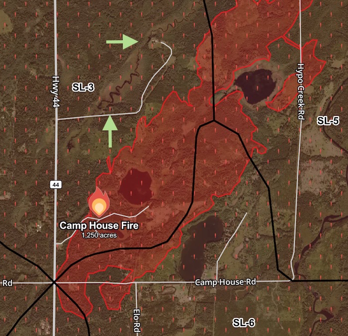
Our cabin was located just above the lower green arrow. My friend's home, office, & outbuildings can be seen in the cleared area next to the upper arrow. The forecast for the next day was for the wind to turn due south and gust to 20 mph. There was no question that their property would be engulfed!
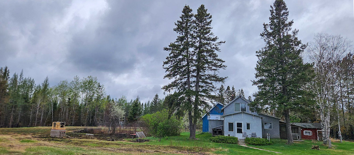
My friend thinks that their compound was considered defensible
by fire fighters due to several mitigation steps they had taken over the years. First, their buildings are surrounded by a large meadow with few trees. Second, in the fall they had undertaken understory mulching, which decreased the fuel available to the fire.
The photo below shows how close the fire got to their 100 year old barn (this may have been a deliberately set backfire). There is a small creek with beaver dam just off to the left that may have been used as a ready source of water.
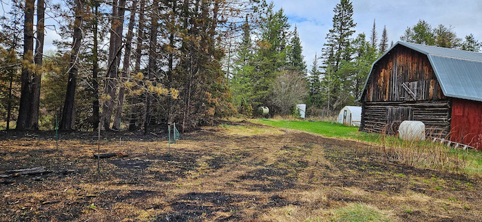
The burned area to the left was a wildflower meadow, which will easily recover. The few trees next to the house appear to be untouched.
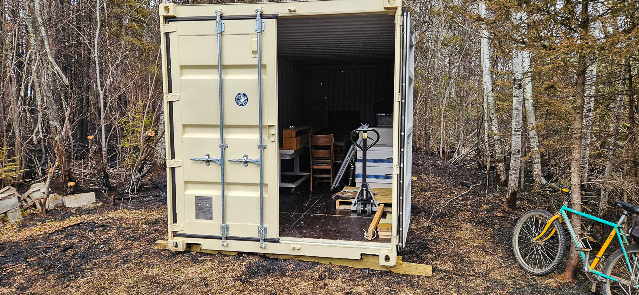
Finally, my friend was about to start a major refurb of the cabin. He had just leased a storage container and was in the process of filling it up. The items in the container were not damaged.🙂
- Aftermath Photos by Peter Berger
- Pre-Fire Photos by Richard Rathe
- Other Images from Public Sources